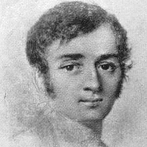
Joseph Nicollet and his map
French scientist, geographer, and mathematician Joseph Nicollet led three important expeditions from 1836 through 1839. His Map of the Hydrographical Basin of the Upper Mississippi covered parts of what would become eight states, and was the first to illustrate the height of land on a map–critically important in an area

X Marks the Spot
Traverse des Sioux has always been a great gathering place for people in this area. Human life here dates back 9,000 years. We don’t think about this much today but, the geography of this area makes it an ideal place to live.
- 1
- 2