The Changing Shape of Nicollet County
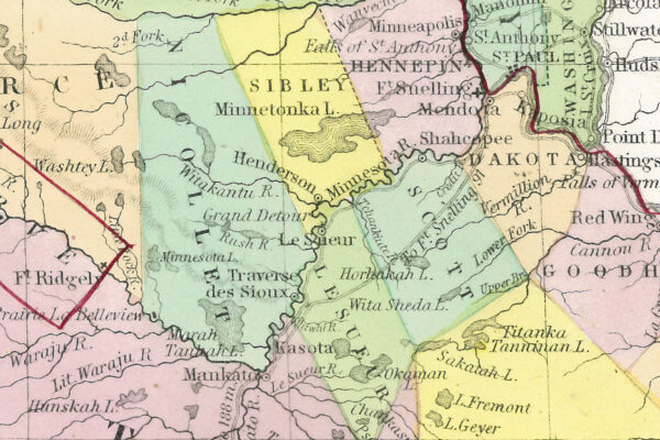
When Nicollet County was first established in 1853, its borders looked very different from today. Early maps placed its northern boundary along the Crow River, and the county seat moved before settling in St. Peter. Over time, township boundaries evolved, shaping the county we know now. Explore the story of
Lowertown, North Mankato: History & Heritage
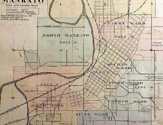
The history of Lowertown in North Mankato, Minnesota, is a tale of geographical changes and shifting boundaries. Initially considered wasteland, the area gained economic value with the construction of a 4-lane highway and subsequent commercial development. The boundary changes and historical events, including floods and proposals for city unification, have

Author Talk with Cindy Wilson: Vignettes from my Books Featuring the St. Peter area, 1879-1881
Author Cindy Wilson will introduce us to the amazing family of railroad surveyor Charles Wood Irish, along with stories from her new book that have an area connection.
Nicollet County Duo Collected Rural School Stories
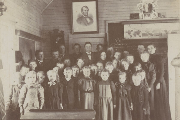
Nicollet County duo collected rural school stories By Bob Sandeen, NCHS Research Assistant Beginning in the 1850s, minutes of the Nicollet County Board meetings contain written descriptions and maps that defined the boundaries of the county’s school districts as they were formed. The Nicollet County Historical Society’s archives include maps